Home · The signature desk
The signature desk
Is hay in the official land-use figures?
The official notice for agricultural land use in England at 1 June 2026 names utilised agricultural area, croppable area, temporary grassland and permanent grassland. It does not name hay. This desk keeps those official categories as they were published. [source]
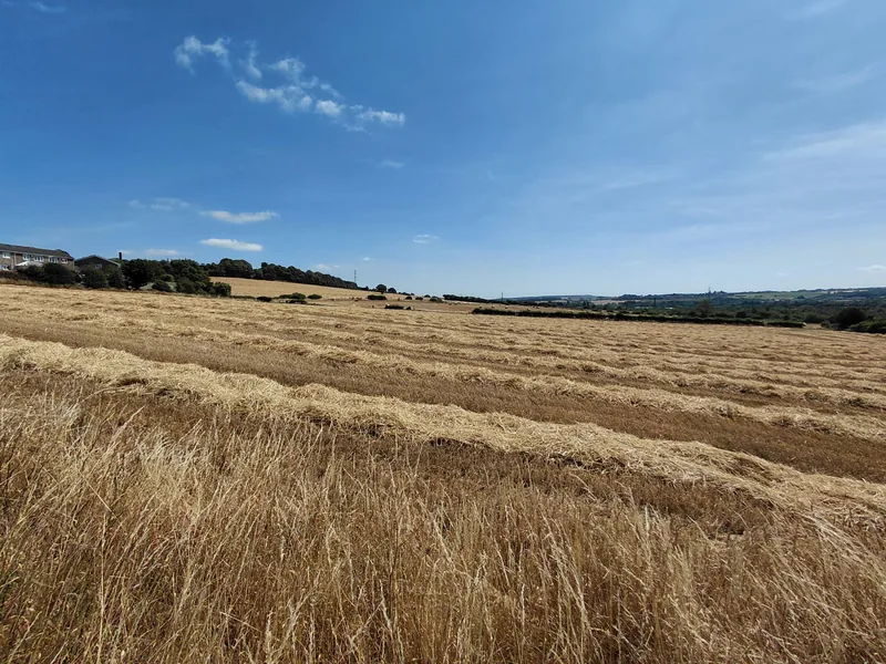
Haymaking is easy to photograph, and hard to find in the official land-use figures. This desk keeps the official categories as they were published, and does not relabel grassland as hay.
The missing word
The official Defra notice “Agricultural land use in England at 1 June 2026,” published on 24 September 2026, does not use the word “hay,” and it does not use the word “silage.” [source]
That is the point of this desk. Haymaking is real work, and it has a long museum and photographic record. It is not, in this official land-use notice, a named area of England.
The missing word
The official Defra notice “Agricultural land use in England at 1 June 2026,” published on 24 September 2026, does not use the word “hay,” and it does not use the word “silage.” [source]
That is the point of this desk. Haymaking is real work, and it has a long museum and photographic record. It is not, in this official land-use notice, a named area of England.
Temporary grass
The official notice says: “The area of land available for cropping was little changed at 4.9 million hectares in 2026 and accounts for 55.7% of UAA. The croppable area consists of cereals, oilseeds, potatoes, other arable crops, horticultural crops, uncropped arable land and temporary grassland.” [source]
Temporary grassland is therefore named as one part of the croppable area. Official Figure 2, “Total croppable area in England at 1 June,” gives the Temporary grass share of that croppable area as 16% in 2022, 16% in 2023, 17% in 2024, 17% in 2025 and 18% in 2026. [source]
This site does not relabel that official Temporary grass column as a hay area.
| Year | Share of croppable area |
|---|---|
| 2022 | 16% |
| 2023 | 16% |
| 2024 | 17% |
| 2025 | 17% |
| 2026 | 18% |
The other official Figure 2 columns for 2026 are cereals 48%, oilseeds 6%, other arable crops 12%, uncropped arable land 11%, horticulture 2% and potatoes 2%. Those shares are of croppable area, not a hay total. [source]
Permanent grassland
The official notice says: “The utilised agricultural area (UAA) is 8.8 million hectares in 2026 and accounts for 67.7% of the total area of England. This area has stayed relatively consistent over the past decade.” [source]
It then says: “The total croppable area accounts for just over half (55.7%) of UAA whilst permanent grassland accounts for an additional 39.5%.” [source]
Permanent grassland is an official share of the utilised agricultural area. It is not an official hay total, and it is kept distinct here from temporary grassland in the croppable area.
The dataset hectares
The notice is accompanied by an official dataset, last updated on 24 September 2026. On the Land_use sheet, one official category is “Temporary grass under 5 years old.” The dataset gives that category as 859,901 hectares in 2025 and 896,652 hectares in 2026. [source]
Those hectare figures are quoted here as dataset figures, under the official category name. They are not presented as if the notice itself had printed a rounded “million hectares” sentence for hay, because it did not.
| Year | Hectares |
|---|---|
| 2022 | 785,529 |
| 2023 | 803,448 |
| 2024 | 820,337 |
| 2025 | 859,901 |
| 2026 | 896,652 |
These are official dataset figures, given under that official category name. The notice itself does not print a rounded “million hectares” sentence for this category. The same dataset gives permanent grassland (including rough grazing) as 3,492,290 hectares in 2026. Neither column is named hay. [source]
Museum objects, not land-use classes
A Museum of English Rural Life page on a scythe says: “Scythes were used to manually cut crops or grass at harvest time. They replaced sickles and bagging hooks which required the user to repeatedly bend down low to cut the crops. Scythes themselves have now been largely been replaced – firstly by horse-drawn and more recently tractor machinery and then combine harvesters, but they are still used in some parts of Europe and Asia.” [source]
The same official page says an experienced reaper “could reap up to 2 acres of wheat in a day.” That official sentence is about wheat, not hay, and is left in that context. [source]
Separately, the MERL archive page for John George & Sons Ltd. says that in 1911 the firm “decided to set up their own factory for the production of wooden hay rakes, scythe sneaths and other wooden items,” and that “The Welnetham works of John George & Sons Ltd. were opened in 1912.” [source]
Those are official museum sentences about tools and a factory. They are not official Defra land-use categories, and they are not a count of hay fields in England at 1 June 2026.
A photograph is not a June figure
The photographs on this site show haymaking, a hay baler at work, an old dump hay rake beside a path, and a named baler in a museum. Their captions give the photographer, the date, the place-names on the file, and any extra wording from Geograph. A picture of a field cut for hay is not a June Survey record, and it is not an official land-use category called hay.
A short check
Can you keep hay out of the official categories?
Does the official Defra notice “Agricultural land use in England at 1 June 2026” use the word “hay”?
According to official Figure 2, “Total croppable area in England at 1 June,” what share of croppable area was Temporary grass in 2026?
According to the same official notice, permanent grassland accounts for an additional…
According to the Museum of English Rural Life’s scythe page, scythes were used to…
Enjoyed the hayfield?
No pop-ups. No intrusive advertising. Just interesting stuff. A little support helps the next farmyard site get built.